August 20, 2024

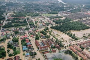
Geographical, meteorological, and human factors combine to cause frequent and catastrophic flooding in Bangladesh, a country known for its dynamic culture and stunning natural surroundings. Due to its location in the delta of some of the biggest rivers in the world, the nation is especially susceptible to floods, which have a significant negative influence on both its population and economy. This article explores Bangladesh’s main causes of flooding, offering a thorough grasp of the elements influencing this enduring problem.
Geographic and Climatic Factors
1) Low-lying Ground:
Bangladesh’s vulnerability to flooding is mostly due to its geographic location. With an average elevation of only 1 to 10 meters above sea level, the nation is a low-lying delta. This makes it highly vulnerable to flooding, particularly during periods of intense precipitation and high river flows.
2) Principal River Networks:
The convergence of Bangladesh’s three rivers—the Ganges (Padma), Brahmaputra (Jamuna), and Meghna—is essential to the nation’s flood dynamics. These rivers carry enormous volumes of water during the monsoon season, which causes overflow and floods in the surrounding communities. Flood patterns can also be altered by changes in river courses and sediment deposition.

Seasonal Factors
River flows into Bangladesh are boosted by glacial melt from the Himalayas in the spring and summer. The seasonal rise in water level may be a factor in river inundation and swell.Rainfall and storm surges are potential consequences of tropical cyclones, which are becoming more common and powerful as a result of climate change. These occurrences cause infrastructure damage and coastal flooding.
Conclusion
